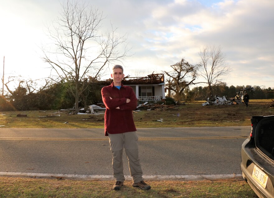
Tornadoes aren’t common here western North Carolina, but they are in the southeast and when they strike, they tend to be deadlier and more destructive than in other parts of the country.
A research team at UNC Asheville is working to figure out why southeastern storms are so lethal by retracing the footprints of twisters the way detectives investigate a crime scene.
WCQS's Helen Chickering reports.

It was just minutes into the NFC championship game.
“Touchdown Atlanta!”
The Atlanta Falcons against the Green Bay Packers in the Georgia dome, when a warning flashed across TV screens across the southeast.
Andrew Gorton, WALB Meteorologist: “This is a serious situation, we’re talking about possibility of a tornado”
You can hear the urgency in meteorologist, Andrew Gorton’s voice as he shared the forecast on WALB, the NBC affiliate in Albany Georgia, about 180 miles south of Atlanta.
Andrew Gorton, WALB Meteorologist, “Seek shelter, do not stick by a TV”
Sixteen people were killed in the series of deadly tornadoes that tore through Albany and surrounding communities that Sunday afternoon. Chris Godfrey arrived on the scene, just days later.
“At one point, I had to stop and look around and realize where I was, in the middle of a disaster area, and it’s humbling,” says Godfrey.

Godfrey is professor of Atmospheric sciences at UNC Asheville. He and a team of student researchers spent several days combing through the debris and studying the landscape.
“Every homeowner we encountered was very nice,” says Chris Godfrey, Ph.D., Associate Professor of Atmospheric Sciences, UNC Asheville, “People were also surprisingly willing to let us poke around their yards in the name of science.”
The science is part of a federally funded research program, calledVortex Southeast. The goal, help improve extreme weather forecasting and warnings in the southeast by identifying environmental factors that affect the formation, intensity and path of severe weather.
“Some meteorologists say, ‘No, the same thing happens everywhere to make tornadoes.’ On the other hand we have a unique set of surface characteristics like hills and trees and a particular concentration of mobile homes or types of structures that may not be built as well, “says Godfrey.
By examining the aftermath, Godfrey’s team is trying to figure out how those unique surface characteristics impact the level of damage caused by tornadoes.
“For example trees could shelter houses and reduce wind speed near the ground, but that doesn’t help if the trees are so close that they fall on the house, “ says Godfrey, “We saw this in the Radium Springs Neighborhood in Albany Georgia, most of the home damage was caused by falling trees and not directly by wind. One house in particular was sliced completely in half by a falling tree, but it only had a few shingles that were lost, due to the wind.”
Sophomore Alex Flynt was part of the Albany field team.
“It really hits you how big and strong tornadoes are, “says Flynt.
While the scene was dramatic, the work was tedious. Flynt spent most of the time studying tree damage, tagging the location, species and fall direction of trees, and mapping building damage.
“A good amount of the time, we walked around the community, trying to piece out where certain debris came from, “says Flynt.
By studying the debris path, the researchers hope to learn more about the role of weaker structures like mobile homes which often break apart and are blown into other structures, causing more damage than the wind alone.
“We surveyed one spot around three houses in one day and I walked over ten miles around these three houses simply taking pictures of debris with the camera that geotags the coordinates of these.”
Those pictures and other information will be used to create detailed maps of the tornado aftermath that will be compared to images of the same areas, before the storm.
Junior Sam O’Donnell is using Google Earth to create those ‘before’ models.
“That’s kind of a weird thing to be looking at. I’m looking at a structure that is there, and I’m mapping it out, but in reality you know that maybe it’s no longer there.” Says O’Donnell.
“ We are awash in data, but we hope by the end of this year, we hope to use the information we collect to find ways to find ways to make communities safer,” says Godfrey.
By uncovering the unique characteristics of southeastern tornadoes. For WCQS news, I’m Helen Chickering.
For more information about the VORTEX-SE program clickhere


